
April Weather Patterns: Milder Temperatures and Increased Precipitation But Low Snowpack
Overview of April’s Weather Trends
April 2026 has ushered in milder temperatures compared to March, accompanied by increased precipitation across California. Notably, many coastal regions and the Sierra Nevada have experienced above-average rainfall; however, the snowpack remains alarmingly low.
Map illustrating the precipitation anomalies for early April 2026 across California. (Source: climatetoolbox.org)
Unpredictable Water Year
The water year of 2025-2026 has been characterized by extreme variability. It commenced with record-breaking rainfall from October to December, including the wettest October to December period ever recorded in areas like Santa Barbara and Ventura. However, by March, California faced some of the highest temperatures on record, compounded by an exceptional dryness.
Now, in April, weather patterns have shifted, bringing back damp conditions especially favorable for the northern segments of the state. Mountain snowfall is noteworthy, with some locations in the Sierra looking at their top-3 wettest Aprils on record. Despite cooler temperatures than March, they still remain above long-term averages, particularly along California’s central and southern coastline, influenced by anomalously high ocean temperatures.
Upcoming Storms and Weather Alerts
Late-Season Storm Predictions
This week, a “bowling ball” low-pressure system is expected to move into Northern California, causing additional rainfall and mountain snowfall while scattering thunderstorms across the region. Southern California is likely to remain relatively dry, although northern areas prepare for significant late-season precipitation.
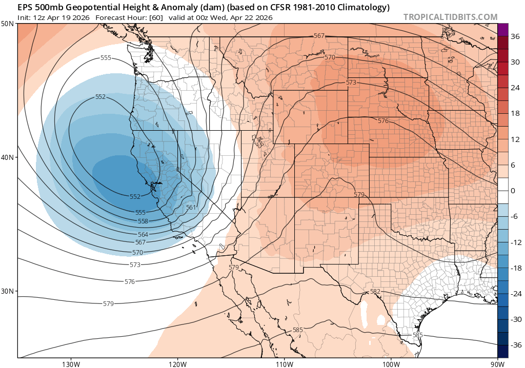
ECMWF forecast showing the incoming weather system for Northern California. (Source: tropicaltidbits.com)
Despite the ongoing active weather pattern, this week’s storm may not achieve the same intensity as the previous system. The initial wave of moisture may even underperform relative to model expectations, though a secondary wave could provide stronger precipitation by Tuesday.
Precipitation Outlook
Forecasts indicate that most northern and central locations will receive 0.5 to 1 inch of rain, with higher elevations potentially getting up to 2 inches. This could significantly boost April’s monthly totals, emphasizing California’s rainy season’s resilience against dryness.
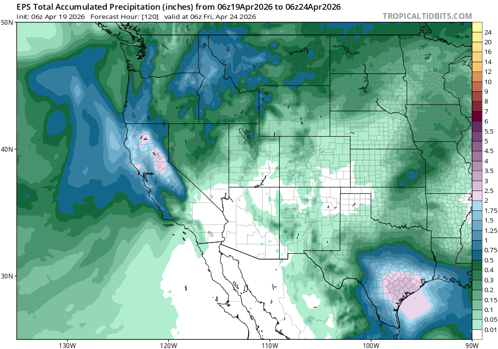
Expected precipitation totals over the coming days across California. (Source: tropicaltidbits.com)
Future Weather Patterns
Uncertain Forecasts for Late April
As we move toward late April and early May, uncertainty increases in weather predictions. Although recent systems have brought substantial rainfall, there are no signals that similarly impactful storms are on the horizon. Nevertheless, lighter precipitation events may persist.
The prevailing subtropical jet stream is anticipated to strengthen, having a considerable impact on weather trends across California. This influences not only local climate but also plays a role in larger weather systems, including potential hurricanes later in the summer.
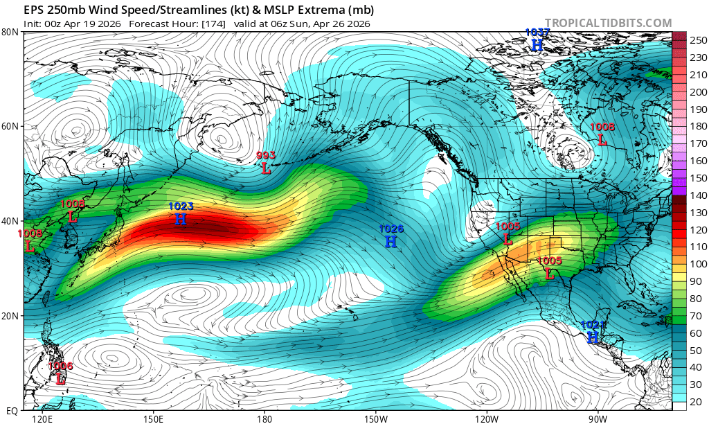
Projected jet stream conditions in late April suggesting an active weather season ahead. (Source: tropicaltidbits.com)
Oceanic Influences on Weather Patterns
Record Oceanic Warmth
An intense marine heatwave has developed across the northeastern Pacific, affecting conditions from Hawaii to California. Sea surface temperatures are currently at record levels, significantly influencing air temperatures along the coast.
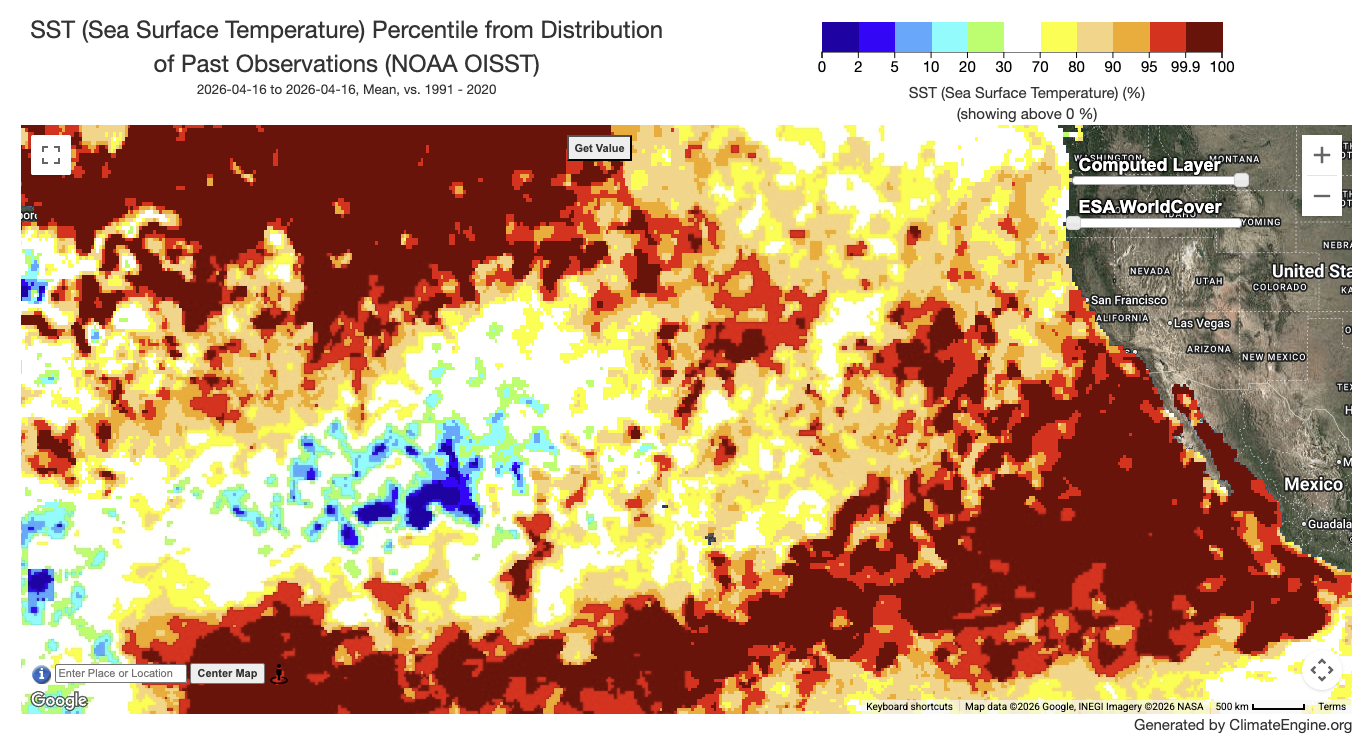
Visual representation of current warm ocean surface temperatures along the Pacific Coast. (Source: climateengine.org)
This extraordinary warmth is likely to persist into the coming months, potentially leading to a distinct summer climate in California characterized by warmer overnight temperatures and perhaps elevated humidity levels.
Implications for Seasonal Weather
The ongoing warmth could contribute to a muted marine layer season and potentially increase the incidence of moisture-laden weather systems across Southern California. This phenomenon may lead to heavier rainfall events later in the summer, particularly if El Niño conditions develop.
Engage with Weather Updates
Stay informed about the evolving weather patterns by joining live updates and discussions. Keep an eye on forecasts and prepare for dynamic weather changes throughout the season.
For continued news and insights on this topic, check out Weather West.
By understanding the interplay of these weather trends and oceanic conditions, residents can better prepare for the varied climate scenarios that lie ahead.