
April Weather Update: Transition from Record Warmth to Active Conditions in California
After a record-setting warmth in March 2026, California and much of the western United States are experiencing a more fluctuating weather pattern in April. While early April began with high temperatures, the overall forecast suggests that this month will bring more dynamic weather, marked by increased storm activity and temperature variability.
Record-Breaking Warmth in March
March 2026 will be remembered as one of the hottest months on record throughout California and the western U.S. Unfortunately, this atypical warmth has significantly impacted the snowpack levels, which are now near all-time lows for this time of year. Recent weather patterns have shown a slight uptick, but significantly warmer temperatures have returned, leaving California once again grappling with atypical conditions for the season.
Shift in Weather Patterns
Fortunately, April appears poised to adopt a more active weather regime. The expectation is for temperatures to fluctuate between warm and cool, rather than being entrenched in continuous heat. This change is already signaled by the meteorological forecasts predicting a more engaging April.
Thunderstorm Potential in Northern California
From Wednesday to Friday, Northern California is expected to see some unusual weather events with the potential for thunderstorms. A slow-moving cut-off low-pressure system will approach the coastline and combine with moist subtropical air. As this system interacts with existing warm air near the surface, it is likely to create conditions favorable for thunderstorm activity.
Animation of expected lightning activity across California (source: pivotalweather.com)
Wednesday will see thunderstorm activity primarily in the northern Sacramento Valley, Coast Ranges, and Sierra foothills. As the week progresses, especially on Thursday and Friday, the areas of concern will expand to cover much of the Central Valley and the Bay Area.
On the lookout for severe thunderstorms, the northern Sacramento Valley appears to be the most likely area for intense weather activity, but overall instability could lead to stronger storms taking shape across various regions. A significant atmospheric energy measurement, known as CAPE, could exceed 1,500 J/kg, indicating a robust thunderstorm potential.
Continued Unsettled Conditions
The active pattern is expected to persist through the weekend. On Saturday, a second low-pressure system will move towards the California coast. This colder system will have the capability to generate organized showers, offering additional precipitation to the region, including Southern California.
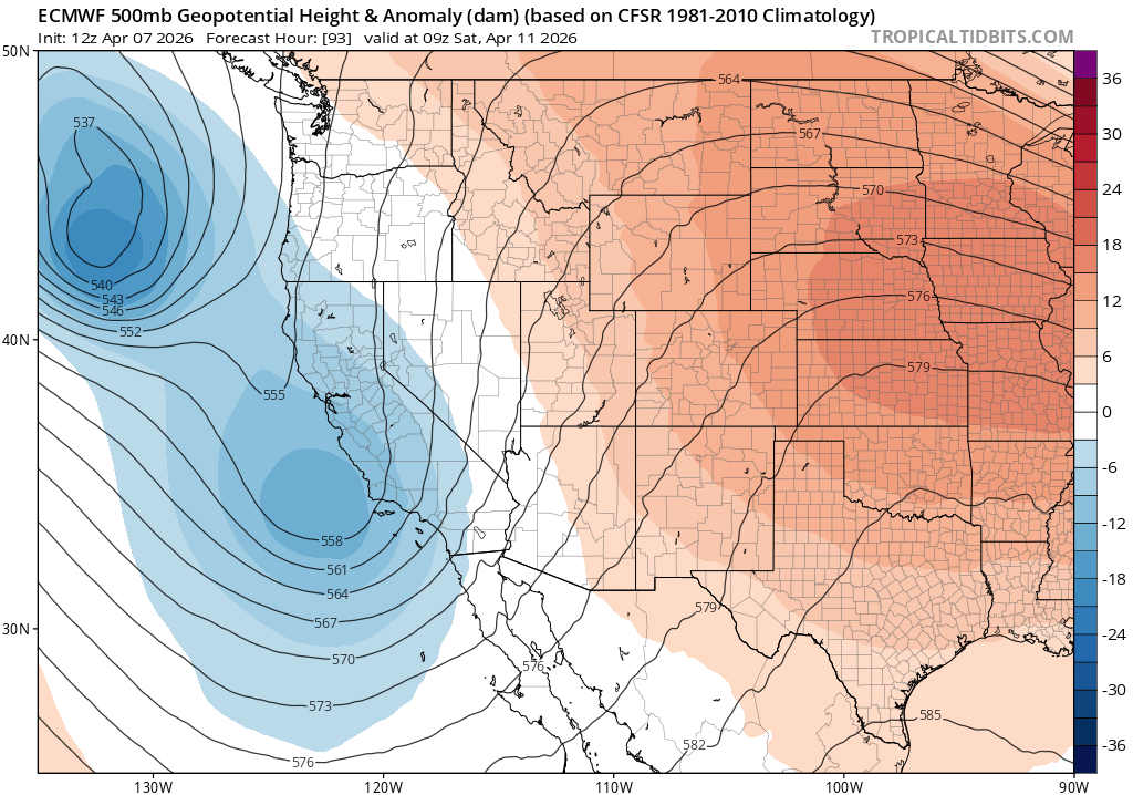
Snapshot of upper atmosphere conditions for late Friday night (source: tropicaltidbits.com)
The initial weather system will bring rain even to the Sierra high peaks, while the incoming second system will initially have high snow levels but is expected to lower them, introducing snowfall to elevations below 6,000 feet by the end of the weekend. This is a significant departure from March, which saw almost no snowfall.
Implications for the Sierra Nevada
April is projected to be a significantly snowier month compared to the previous one, offering beneficial moisture for late-season soil and runoff requirements. Snow and rain accumulation is crucial this time of year, considering the region’s ongoing drought conditions.
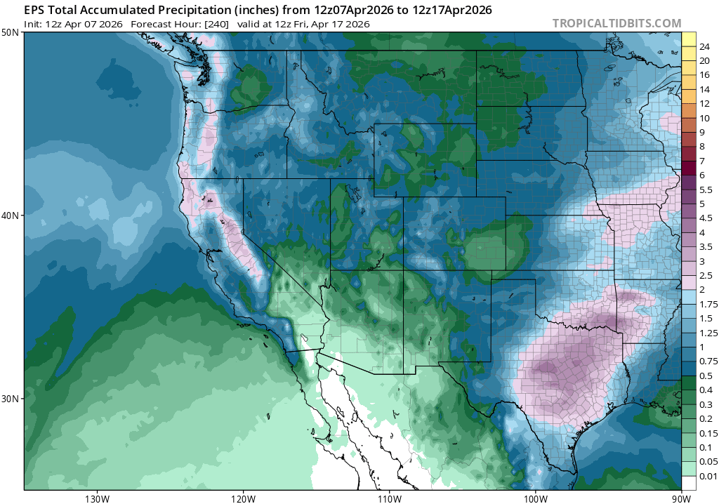
Forecasted precipitation amounts for April (source: tropicaltidbits.com)
Uncertain Tropical Influences Ahead
Beyond the immediate forecast, there is considerable unpredictability regarding tropical influences that could affect conditions in late April. A strong West Pacific typhoon is expected to recurve into mid-latitude airflows, which may provoke a more chaotic atmospheric pattern over North America.
This could lead to a variety of outcomes, from abnormal dryness to unexpected storms, as the Pacific jet stream responds to this added energy. Such patterns have historically brought notable weather fluctuations, making the long-term forecast particularly uncertain.
Join the Discussion
Stay informed with the latest weather developments, including thunderstorm potentials and shifting conditions throughout April. Join the upcoming YouTube livestream on April 8th at 2 PM PT for a discussion on these weather trends and what they signify for the coming weeks.
Stay updated, and let’s monitor this dynamic April weather together!